
Historical Significance
The Mitad del Mundo's history connects a specific measurement to Ecuador's national identity:
- The French Geodesic Mission (1735–1744) — Ten French scientists led by Charles Marie de la Condamine traveled to equatorial South America to measure the length of a degree of latitude at the equator; their measurement confirmed that one degree at the equator is slightly shorter than one degree nearer the poles, proving the earth is oblate spheroid (flattened at the poles); this was one of the great scientific achievements of the Enlightenment
- Ecuador's name — Ecuador is one of only two countries in the world named after a geographical phenomenon (the equator; the other is the Dominican Republic, named after a saint). The 18th-century measurements by the French Mission placed the equatorial line precisely through the territory, and when the country declared independence in 1830 it chose the geographical feature rather than any pre-Columbian or colonial name
- The GPS correction — When GPS technology became precise enough to confirm coordinates in the 1990s, the 240-meter discrepancy in the monument's position was documented; rather than moving the monument, Ecuador used the discovery to celebrate both the ingenuity of 18th-century measurement technology and the precision of modern science
When to Visit
Mitad del Mundo complex: Daily 9 AM–6 PM. Monument tower (Ethnographic Museum): Same hours. Intiñan Solar Museum: Daily 9:30 AM–5 PM. Best time to visit: Mornings on clear days; equatorial sun is intense by midday. Avoid: Weekends between 11 AM and 2 PM when organized tour groups dominate the plaza. Photography: The yellow line and monument photograph best from the eastern side in the morning.
Admission and Costs
Mitad del Mundo plaza (outdoor): Free. Monument/museum tower entry: $4 USD adults. Intiñan Solar Museum: $4 USD adults. Guided tour of both sites with transport from Quito: $30–80 per person. Taxi from central Quito: $15–25 each way.
The Case for a Guide
The Mitad del Mundo is more interesting with a guide who knows its full scientific and cultural story:
- The Coriolis effect demonstrations — At the Intiñan Museum, a guide conducts water drain demonstrations on both sides of and exactly on the equatorial line; whether the effect is visible at this scale is contested by physicists, but the demonstration is compelling and a guide can explain both the legitimate science and the theatricality of the presentation
- The measurement story — The journey of the French Geodesic Mission across the Andes in 1735, the equipment they used, the disputes among the scientists, and the decade-long effort required to make measurements that could be contested and refined — a guide who knows the story transforms the monument from a yellow tower to a chapter in Enlightenment scientific history
- Indigenous solar calendar — The Intiñan site also houses reconstructions of the pre-Columbian Quitu-Cara solar calendar system; a guide connects the modern GPS equatorial marker to the pre-Columbian indigenous knowledge of the same geographical phenomenon, showing that the "discovery" of the equator by French scientists was known to local civilizations for thousands of years
Tips for Visitors
Visit both sites: The main monument for the photograph; the Intiñan Museum for the demonstrations — they are 300 meters apart and the combined visit takes 2 hours. Midday sun: Equatorial sun at 2,400 meters is intense — bring a hat and sunscreen even on slightly overcast days. Combine with Quito: Most visitors combine Mitad del Mundo with Quito's historic center and the Teleférico cable car as a full-day northern Quito experience. Shopping: The craft stalls around the main plaza sell Ecuador-specific souvenirs at reasonable prices — Panama hats (which actually originated in Ecuador, not Panama) are the most distinctive purchase.
Frequently Asked Questions
Is the Mitad del Mundo monument actually on the equator?
The original monument — and the yellow line running through the complex — is approximately 240 meters south of the actual equatorial line as determined by modern GPS measurements. The discrepancy arose because the 18th-century French Geodesic Mission that first calculated the equator's position used instruments that were accurate for their era but could not match modern GPS precision. The Intiñan Solar Museum, located approximately 300 meters north of the main monument, sits on coordinates confirmed by GPS to be within a few meters of the actual equatorial line — and offers demonstrations of equatorial phenomena including the Coriolis effect.
How do you get to Mitad del Mundo from Quito?
Mitad del Mundo is 26 kilometers north of Quito city center, approximately 45–60 minutes by car depending on traffic. Options include organized tours from Quito ($30–80 per person, often combined with the historic center), taxis or ride-shares ($15–25 each way), and public bus service (Metabus M-1 from Ofelia terminal, about 45 minutes, under $1). Most visitors combine Mitad del Mundo with other northern Quito attractions including the Teleférico cable car and the Intiñan Solar Museum.
What can visitors do at the Mitad del Mundo complex?
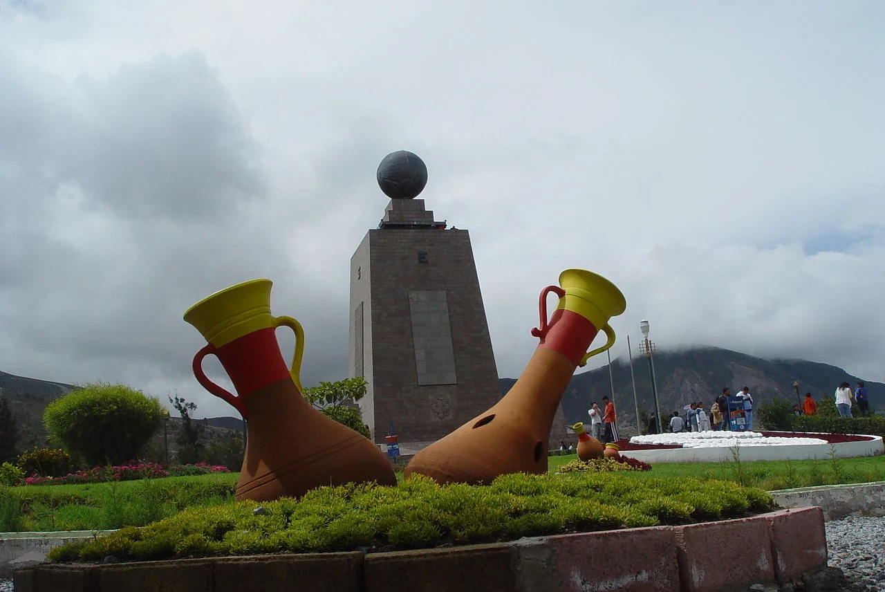
The main monument is a 30-meter yellow tower with a globe on top, surrounded by a pedestrianized plaza with restaurants and craft shops. The tower interior houses the Luis Cordero Ethnographic Museum with exhibits on Ecuador's indigenous cultures. The yellow line runs through the plaza. Adjacent to the main complex, the Intiñan Solar Museum offers more intimate demonstrations of equatorial phenomena — a guide can show visitors that water drains in no particular direction exactly on the equatorial line and spins clockwise just meters south and counterclockwise just meters north.