
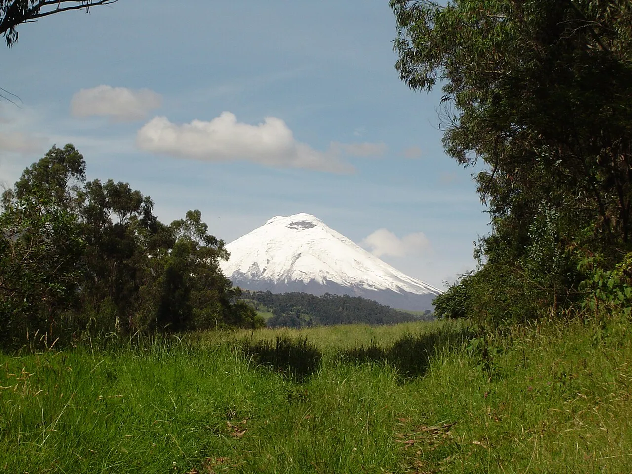
Formation
Cotopaxi's ecological and geological character is extraordinary:
- The glacier — Cotopaxi's summit glacier covers approximately 13 square kilometers despite the equatorial location; the glacier has been retreating measurably since the 1970s as a result of climate change, and a guide who has made summit attempts over multiple years can show the visible retreat from specific reference points visible from the refuge
- The 1877 lahar flow — Cotopaxi's most destructive eruption in historical record sent lahars (volcanic mudflows) traveling 100 kilometers north to the Pacific coast and 60 kilometers south to Ambato; the debris deposits are visible from the Pan-American Highway and a guide can explain the destruction and its impact on the settlements in the valley below
- The páramo ecosystem — The tussock grass of the high páramo is among the world's most effective water-capture ecosystems; its sponge-like capacity to absorb moisture from clouds and slowly release it into highland rivers is what supplies Quito and the central Andes with year-round water — a guide explains why the destruction of páramo by agricultural expansion is an immediate threat to urban water supplies
When to Visit
Park entrance: Daily 7 AM–5 PM. Best volcano views: 7–10 AM before clouds form around the summit. Laguna Limpiopungo: Accessible year-round; highest water levels in the wet season (January–May). Refuge hike: Allow 3–4 hours round trip from the upper parking lot at 4,500m. Summit climbs: Midnight starts from the refuge; summit by dawn. Dry season (June–September): Best months for clear views and summit attempts.
Admission and Costs
Park entry: $2 USD per adult. Laguna Limpiopungo access: Included in park entry. Refuge José Ribas hike (to 4,864m): Included in park entry; no summit permit currently required for the non-technical section. Summit expedition (ASEGUIM guide, equipment, 2 days): $200–350 per person with a certified guide. Day tour from Quito (transport + guide): $60–120 per person.
The Case for a Guide
Cotopaxi is accessible without a guide but far more rewarding with one:
- Altitude management — A certified guide monitors signs of altitude sickness throughout the day, adjusts the pace of climbing to the fitness level of each visitor, and carries emergency oxygen for the upper sections above 4,500 meters; this is not optional precaution but practical preparation for conditions that can deteriorate rapidly
- Wildlife identification — The páramo birds and mammals are most active early morning and require specialist knowledge to identify; a guide who regularly works in the park knows the current territories of condors, the locations of wild horse herds, and the specific polylepis groves where Andean hummingbirds feed in greatest concentration
- Volcanic monitoring context — A guide with geological training can explain what the fumarolic emissions from the summit mean in context of the volcano's current alert level, the historical eruption patterns, and the evacuation plans that the park and surrounding communities maintain — transforming a beautiful snow cone into a living geological phenomenon
Tips for Visitors
Acclimatize first: Arrive in Quito (2,850m) at least one full day before visiting Cotopaxi (4,500m+); the altitude difference is significant and rapid ascent causes the most severe symptoms, and a rest day exploring Quito's historic center is the ideal way to spend it. Dry season: June through September offers the best chance of clear summit views; January through April is wettest and cloud cover is most persistent. Layers: Temperature at the refuge (4,864m) is typically 0–5°C even in summer; bring a warm fleece and wind layer regardless of Quito weather. Horses: Wild Cotopaxi horses have grazed the park for generations and are remarkably photogenic near the Laguna Limpiopungo parking area — arrive early for the best chance of close encounters.
Frequently Asked Questions
Is Cotopaxi safe to visit given it is active?
Cotopaxi is continuously monitored by Ecuador's Instituto Geofísico, and the national park has protocols for varying alert levels. The park closed for approximately two years following elevated activity in 2015–2016 and has since reopened to full visitor access. Current activity is typically low-level fumarolic emissions from the summit crater, which pose no risk to visitors in the park below. Always check the Instituto Geofísico website (igepn.edu.ec) for current volcanic alert levels before visiting, and follow your guide's instructions if activity changes during your visit.
Can visitors summit Cotopaxi?
Summit attempts (to 5,897 meters) require ASEGUIM (Ecuadorian Mountain Guides Association) certified guides, technical mountaineering equipment, and at least one prior acclimatization day at altitude. Most expeditions begin at the Refuge José Ribas at 4,864 meters around midnight and summit at dawn to avoid afternoon weather. The technical difficulty is moderate (Grade PD+) but the altitude is demanding — altitude sickness at 5,000+ meters affects most climbers to some degree. Many visitors choose instead to hike to the refuge and snowline at 5,000 meters, which is achievable with standard fitness and proper acclimatization.
How do you get to Cotopaxi National Park from Quito?
Cotopaxi National Park is 60 kilometers south of Quito, approximately 1.5–2 hours by car depending on traffic and the condition of the park access road. Most visitors join organized day trips from Quito ($60–120 per person, including transport, guide, and park entry) or hire a private driver for the day ($80–150). The Pan-American Highway runs adjacent to the park; the main entrance is at Marquez and requires 4WD vehicles for the upper sections. Arriving by bus is possible but leaves visitors 10+ kilometers from the park attractions.