
Observation Spots
Formation
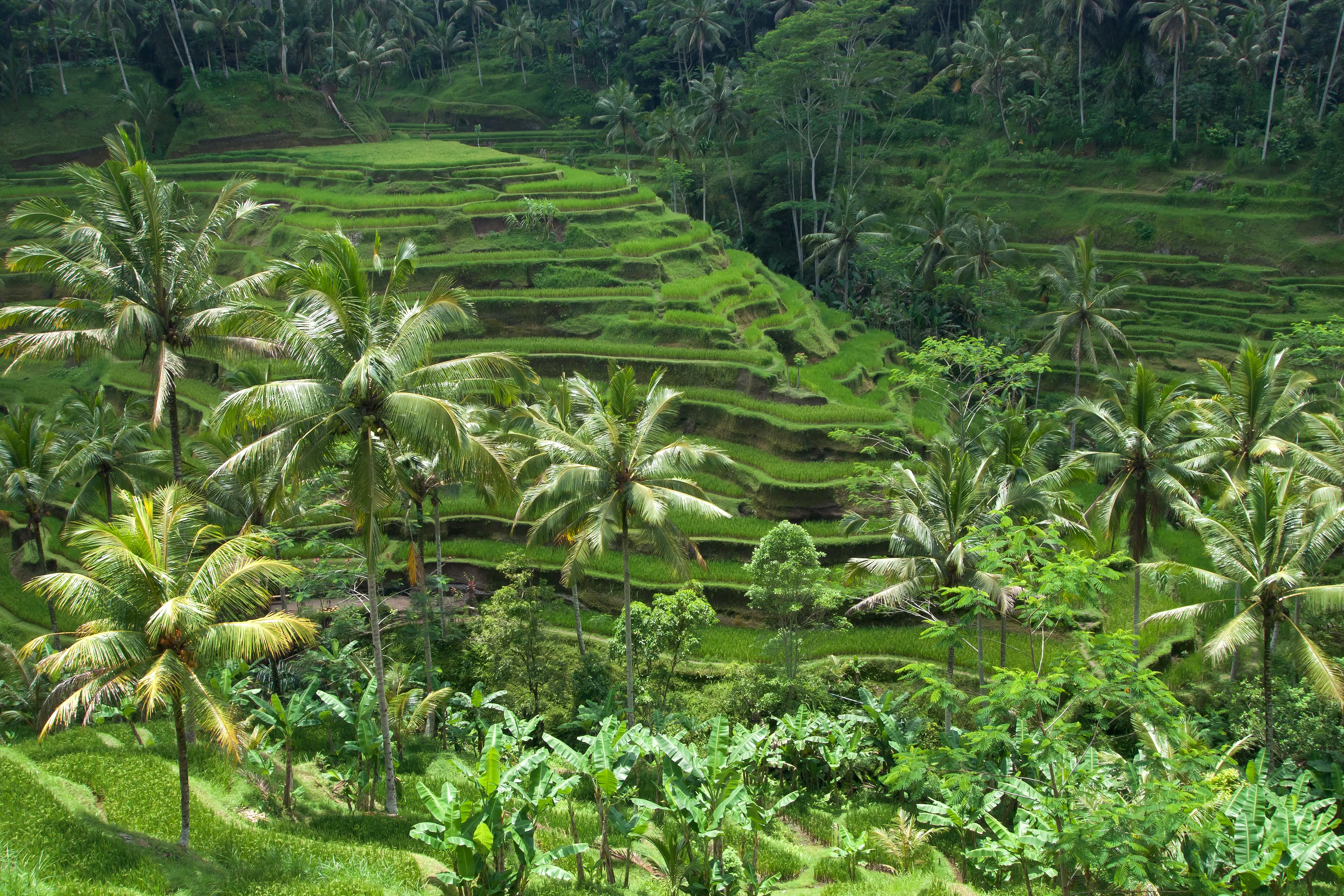
Bali is a volcanic island, and Tegallalang exists because of it. The central highlands are built from andesitic ash and lava shed by the still-active stratovolcanoes Mount Batur and Mount Agung, whose repeated eruptions have laid down deep, mineral-rich soils across the region north of Ubud. Weathered volcanic ash releases potassium, phosphorus, and trace minerals slowly into the paddy water, which is why Subak farmers have never depended on the chemical fertilisers that lower-altitude, non-volcanic rice systems require.
The terraces themselves were cut by hand over many generations. Farmers carved horizontal steps into the sloping valley wall, then built earthen bunds (pematang) at each level to hold a few centimetres of standing water, and dug channels to lead water from the upper hillside springs down through each successive terrace before it finally reaches the river at the valley floor. Gravity does all the work: water enters the highest paddy, soaks and levels, then spills through a controlled gap to the terrace below, so a single spring can irrigate dozens of owners in sequence. Coordinating who receives water, and when, is precisely the problem the Subak assemblies and water temples were created to solve.
The site's altitude — approximately 600 metres — is as important as the soil. It keeps daytime temperatures a few degrees below the sweltering coast, reduces the fungal and pest pressures that plague hotter lowland paddies, and gives the terraces the cool morning air and low mist that photographers prize. The gorge's steep walls, meanwhile, are what force the farming into steps in the first place: on this gradient, flat fields are impossible, and the staircase of paddies is simply the only way to farm rice on a mountainside without letting the water — and the topsoil — rush straight to the bottom.
Trails
Most visitors experience Tegallalang from the ridge-top path on the western rim, where a string of cafés and viewpoints looks across the gorge to the terraces opposite. This is the easy option: flat, roadside, and accessible within a few minutes of parking. To actually walk into the landscape, follow the marked descent from the ridge down into the valley — a sequence of steep, uneven stone-and-earth steps that drops you level with the paddies before crossing the valley floor and climbing the far side.
A typical circuit runs roughly like this:
- Start at the West Ridge Café Viewpoint for the classic panorama and to read the terrace layout from above.
- Take the descent path down the western wall, pausing on the Lower Paddy Bund Path to walk the narrow earthen dividers between the lowest terrace levels.
- Cross the stream at the valley floor and climb toward the Valley Swing Terraces on the eastern flank, where the swings and photo platforms cluster.
- Return via the Northern Café Balconies for a higher, quieter view up the valley before rejoining the ridge road.
The full loop covers well under two kilometres but involves a genuine climb back out — hundreds of steps, often slick with clay after rain. Allow 1.5–2 hours at an unhurried pace with photo stops. Sturdy shoes matter far more than distance here; the map of observation points below plots the main vantages so you can plan the descent before committing to it.
Wildlife
A flooded paddy is a working wetland, and because Subak farming uses little or no pesticide the terraces support a surprising density of life. White egrets and pond herons stalk the shallow water for frogs and insects, often lifting off in flocks at dawn; Java kingfishers and small waders work the channel edges; and after dusk the terraces fill with the chorus of frogs and the flicker of fireflies over the water.
Some Tegallalang landowners still practise a version of integrated rice-duck farming, releasing flocks of ducks into harvested or fallow paddies where the birds eat weed seeds, snails, and insect larvae while their droppings fertilise the mud — a closed-loop technique that predates and complements modern organic agriculture. Dragonflies and damselflies patrol the standing water in enormous numbers, an informal sign of the paddies' health, and the bunds themselves host lizards, small snakes, and the occasional monitor. None of this is a managed reserve; it is simply what a thousand years of low-input, water-rich cultivation produces. A guide who knows the valley can point out which fields are currently flooded and most alive with birds, and explain how the Subak's avoidance of heavy chemicals keeps the ecosystem intact.
When to Visit
Open: All hours, effectively. The ridge-top path is accessible from dawn. Best window: 7–9 AM — optimal light, minimum crowds, coolest temperature. Best months: May, June, and September score highest — reliably dry weather with fewer crowds than the July–August peak, and paddies typically at their greenest. Avoid: 10 AM–2 PM in July–August peak season; the path becomes congested and direct overhead sun flattens the terrace shadows. Wet season note: November–March brings daily afternoon rain that makes the descent slippery but leaves the terraces lush and vividly green — plan the walk for the morning before the clouds build. Visit duration: 1.5–2 hours for the ridge path, viewpoints, and one paddy descent; 3 hours if including a swing activity and café stop.
Admission and Costs
- Ridge path access: IDR 10,000–30,000 (USD 1–2) collected at informal gates along the path
- Paddy bund walk: IDR 20,000–50,000 (USD 1.25–3) paid to landowner at base
- Rope swing: IDR 100,000–200,000 (USD 6–13) per person depending on operator
- Café-view seats: Some ridge cafés charge IDR 50,000–100,000 minimum spend for terrace-view seating
- Guide from Ubud (half-day including Tegallalang): IDR 400,000–700,000 (USD 25–45) with transport
The Case for a Guide
The terraces look spectacular in photographs but their significance is invisible without context. A guide unlocks the Subak system's extraordinary achievement:
- Irrigation engineering: Tracing the water flow from the hillside spring temple through each terrace level to the river below reveals an engineering logic designed by farmers rather than engineers — a guide maps the system live in the landscape
- Rice cycle identification: Distinguishing newly planted, mid-growth, and pre-harvest paddies — and knowing which fields in the area are currently at peak green — transforms a generic visit into a precisely timed agricultural experience
- Terrace ownership: Each terrace section belongs to a different family; the cooperative agreements, planting calendars, and water temple ceremonies that coordinate them are a functioning social system a guide can explain through conversations with local farmers
- Cultural pressure context: The tension between tourism income (swings, cafés, Instagram fees) and the agricultural integrity of a UNESCO-inscribed landscape is a live debate in Bali; a guide presents both sides honestly
Tips for Visitors
Rice cycle timing: Ask your guide or hotel about the current planting stage the week before arrival — vivid green shoots (1–3 weeks after planting) offer the most saturated colour photography. Bund walking: The narrow earthen paths between paddy levels require balance and firm shoes; flip-flops are ill-suited for the clay-slippery surfaces after rain. Accessibility: The ridge-top viewpoints and roadside cafés are reachable with minimal walking and suit visitors with limited mobility, but the descent into the valley involves hundreds of steep, uneven steps with no railings and is not wheelchair- or stroller-friendly — plan to enjoy the panorama from the rim if steps are a concern. Swing operators: Choose operators who use properly anchored harness systems and test the equipment before each session; reputable operators display safety certificates. Café choice: Several ridge cafés offer terrace views with seats for purchase of food or drink — a practical way to sit, photograph, and observe the terrace activity without blocking the path. Combined day trip: Tegallalang pairs naturally with Tirta Empul Temple (15 minutes east), the Sacred Monkey Forest back toward Ubud, and the Kintamani volcano viewpoint (30 minutes north) in a single guided day circuit.
Frequently Asked Questions
What time should I arrive at Tegallalang for the best experience?
Arrive between 7 and 9 AM for the optimal combination of light and crowd conditions. Morning light comes from the east and illuminates the terraces' layered depths with raking shadows that emphasise the staircase geometry — this light disappears as the sun rises overhead. By 10 AM, tour buses from South Bali's resort areas begin arriving in volume, and the ridge-top path becomes congested. An early start also catches the most vivid greens of newly planted paddies before midday haze reduces the colour saturation. A guide with transport from Ubud (20 minutes) can time the arrival precisely to match the rice growing cycle, which changes the landscape's character entirely over its 115-day planting period.
What is the Subak irrigation system and why does it matter?
Subak is a 1,000-year-old Balinese cooperative irrigation system that coordinates water distribution to rice paddies through a network of water temples, village assemblies, and hand-dug channels. Instead of centrally controlled infrastructure, Subak allocates water through religious consensus — the water temples at each level of the terrace system hold ceremonies that simultaneously manage irrigation schedules. UNESCO inscribed the Subak Cultural Landscape in 2012 as a living example of a self-organising agricultural system that has produced continuous harvests on volcanic hillsides for over a millennium without irrigation pumps or government administration. Scientists studying Subak's pest management discovered that the religious water-control cycle also constituted an optimal biological pest control schedule — a discovery that revolutionised agricultural systems research.
Is there an entrance fee at Tegallalang?
The terraces themselves have no single official entrance fee, but individual landowners and cooperative associations along the ridge path collect informal fees of IDR 10,000–30,000 (USD 1–2) at various access points — these are locally-managed contributions to terrace maintenance. Activities within the terraces carry separate charges: the rope swing experiences that extend over the valley cost IDR 100,000–200,000 (USD 6–13) per person; walking down into the paddy bunds requires negotiating with the landowner at the base, typically IDR 20,000–50,000. A guide handles these transactions smoothly and knows which operators are reputable.
How do I get to Tegallalang from Ubud or South Bali?
From central Ubud, Tegallalang lies about 20 km north along Jalan Raya Tegallalang — roughly 20–30 minutes by car or scooter, though the single-lane road can slow considerably once the first tour buses arrive after 9 AM. A private driver-guide for the day typically costs IDR 500,000–800,000 with transport and lets you fold in Tirta Empul (15 minutes east) and the Kintamani caldera viewpoint (30 minutes north) on the same loop. From South Bali resort areas such as Seminyak, Canggu, or Kuta, allow 1.5–2 hours each way — the distance is only 40–50 km, but Bali's congested arterial roads make an early start essential if you want to reach the terraces before the light flattens and the ridge path fills. There is no public bus or rail service; ride-hailing apps work from Ubud but drivers are scarce for the return leg from Tegallalang itself.