
Walking Route
Engineering Facts
Chief engineer Joseph Strauss is the name on the plaque, but much of the mathematics that made the bridge stand was the work of senior engineer Charles Ellis, who calculated the stresses in every member and was written out of the credits after falling out with Strauss — the District formally acknowledged his contribution only decades later. Refinements from designer Leon Moisseiff, whose deflection theory permitted a slender, flexible deck, gave the span its graceful proportions.
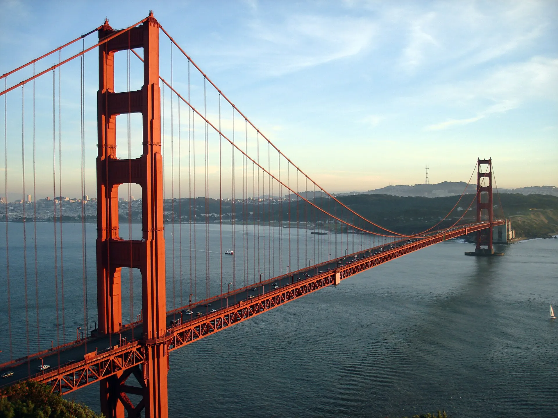
The roadway hangs from two main cables, each 7,650 feet long and just over 36 inches thick, spun from 27,572 pencil-thin wires; laid end to end that wire would run about 80,000 miles, enough to circle the equator three times. The deck sits roughly 220 feet above the water at mean high tide, clearing the tallest ships, and is engineered to swing as much as 27 feet sideways in a gale rather than resist the wind rigidly. During construction Strauss strung a safety net beneath the deck that caught 19 men — the self-styled Halfway to Hell Club — though 11 workers died in all, 10 of them in a single February 1937 accident when a section of scaffold tore through the net. Backed by a $35 million bond that Depression-era ranchers and homeowners secured against their own property, the bridge was not fully paid off until 1971. The full engineering record is published by the Golden Gate Bridge, Highway & Transportation District.
Observation Points
Standing on this bridge without understanding how it was built is like reading the last page of a novel without knowing the story. During the Great Depression, engineers defied skeptics who claimed no structure could withstand the strait's punishing winds and currents. Your guide reveals how the safety net beneath the deck saved nineteen workers who became known as the Halfway to Hell Club, and why chief engineer Joseph Strauss insisted on precautions considered extravagant for the era.
The classic viewpoints each frame the span differently:
- Battery Spencer (Marin Headlands): the elevated, over-the-top postcard angle, unbeatable one hour before sunset.
- Fort Point (beneath the south tower): the only upward view of the deck's understructure, and a filming location for Hitchcock's Vertigo.
- Marshall's Beach and Baker Beach: low, dramatic angles from the San Francisco shore, with wildflowers in spring.
- Crissy Field and the Palace of Fine Arts: a flat waterfront approach walkable in about 30 minutes.
- Vista Point (north landing): the head-on composition with the skyline stacked behind the towers.
Many tours continue to Fort Point or across to the waterfront town of Sausalito, weaving the bridge together with its surrounding landscapes. For another angle on the city's engineering heritage, pair the visit with a ride on the historic cable cars.
When to Visit
The east (bay-side) sidewalk opens to pedestrians at 5:00 AM and closes at 6:30 PM in winter, extending to 9:00 PM through the long-daylight months; cyclists use a 24-hour access arrangement on the ocean-side path. The clearest, fog-free windows fall in September and October — San Francisco's Indian summer — while the marine layer that gives the bridge its drama is thickest from June to August, when the deck's foghorns can sound for hours at a stretch. For photographs, aim for a weekday before 10 AM, when morning fog often lifts and the crowds and tour buses have yet to arrive; 1 hour before sunset from Battery Spencer on the Marin side delivers the warmest light on the towers.
Admission and Costs
Walking or cycling across is always free. Drivers pay a southbound-only toll (into San Francisco), collected entirely electronically — there have been no toll booths since 2013 — currently around $9–10 with FasTrak; the northbound trip to Marin is free. Bike rental: $35-45 for a full day (includes helmet, lock, map). Electric bike rental: $55-75 for a full day (easier for the hills). Guided bike tours: $60-90 per person (includes bike, guide, 3-4 hours). Walking tours: $40-60 per person (2-3 hours with a historian). Private guide: $300-450 for up to 6 people.
The Case for a Guide
Walking the Golden Gate Bridge alone is a beautiful experience — walking it with a guide who knows its engineering biography, its painted history, and its complicated legacy transforms those 1.7 miles into something altogether more profound.
- Why International Orange was chosen: Consulting architect Irving Morrow selected the bridge's distinctive colour specifically because it harmonises with the Marin headlands' ochre rock and the bay's surrounding hills, and because it enhances visibility in fog far better than the grey or black Navy originally proposed; guides explain the political battle Morrow fought to override the Navy's objections.
- Who maintains the paint and how: The bridge's paint is not a single coat applied and forgotten but a continuous maintenance operation — a crew of approximately 38 painters works year-round, touching up sections damaged by weather and salt spray in a cycle that never completes before it begins again; guides explain the difference between the original lead-based paint and the current epoxy system.
- Suicide prevention net installation controversy: The stainless steel safety net below the deck was approved in 2014 after decades of debate and finished in the early 2020s; guides explain the public health argument that won the vote, the aesthetic objections raised during the 50-year discussion, and what the research shows about whether barrier interventions actually reduce overall suicide rates.
- Fort Point underneath the south tower: The 1861 Civil War fort sits directly beneath the south anchorage and was preserved intact when chief engineer Joseph Strauss redesigned the approach specifically to avoid demolishing it; guides lead visitors to Fort Point, which offers the only upward view of the bridge's understructure unavailable from the pedestrian path.
- Best photography viewpoints locals use: The tourist viewpoint at the Welcome Center is crowded and offers a foreshortened angle; guides position visitors at Battery Spencer on the Marin Headlands for the classic postcard composition, Marshall's Beach beneath the south tower for a low dramatic angle, and Hawk Hill for elevated views that include both towers and the bay simultaneously.
Tips for Visitors
Dress in layers: the deck can run 15°F colder and far windier than downtown, so a windproof jacket beats a fashion choice. Wind warning: gusts of 30+ mph are common — secure hats and grip phones tightly over the rail. Fog factor: the bridge can be completely obscured, so check the live webcams before going. East vs. west sidewalk: the east (bay side) is reserved for pedestrians on weekdays and open to both on weekends, while the west (ocean side) is designated for cyclists, separated from walkers. Photography gear: a wide-angle lens is ideal, though a tripod is awkward in the wind. Restrooms: at the south-end Welcome Center and the north-end Vista Point. Timing: allow about an hour to walk out to a tower and back, longer for the full crossing to Marin.
Frequently Asked Questions
When are conditions best for visiting the Golden Gate Bridge?
September and October deliver San Francisco's Indian summer, with the highest probability of clear skies and fog-free views of the bridge's International Orange towers against blue sky. Summer's famous fog can completely obscure the bridge for hours, especially in July, so checking the live webcams before heading out is essential. Spring and early fall offer the longest pedestrian access hours and more comfortable temperatures for walking the full 1.7-mile span.
When can the public visit Golden Gate Bridge?
Pedestrian hours: 5:00 AM - 9:00 PM (6:30 PM in winter). Best for photos: Morning (9-11 AM) when fog often clears. Sunset views: 1 hour before sunset from Battery Spencer (Marin side).
What does a visit to Golden Gate Bridge cost?
Walking the bridge: Free. Bike rental: $35-45 for full day (includes helmet, lock, map). Electric bike rental: $55-75 for full day (easier for hills). Guided bike tours: $60-90 per person (includes bike, guide, 3-4 hours).
What is the best way to experience Golden Gate Bridge?
Dress in warm layers — the deck can be 15°F colder and far windier than downtown, with gusts topping 30 mph. Check the live fog webcams before setting out, since the span can vanish for hours. Walk the east (bay-side) sidewalk for skyline views, and allow roughly an hour to cross the full 1.7 miles and return on foot.