
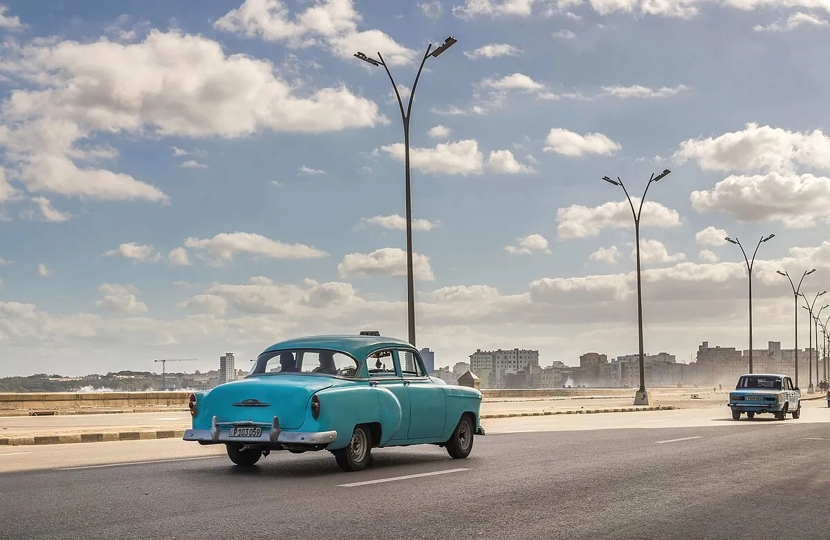
Landmarks Along
Walking the Malecón from east to west, the wall strings together some of Havana's defining monuments:
- Castillo de San Salvador de la Punta — At the eastern mouth of the harbor, this late-16th-century Spanish fortress marks where the promenade begins, facing the Castillo del Morro across the channel; together they once guarded the entrance to colonial Havana
- Monument to the Victims of the USS Maine — Two rusting columns near the Hotel Nacional commemorate the 1898 battleship explosion that triggered the Spanish–American War; the eagle that once crowned it was toppled after 1959 and its remains sit nearby
- Anti-Imperialist Tribune (Tribuna Antiimperialista) — A vast open-air plaza built in 2000 opposite the former US Interests Section, staged for mass political rallies and known locally as the "Protestódromo"
- Monument to Máximo Gómez — A grand marble-and-bronze equestrian statue at the harbor end honoring the Dominican-born general of Cuba's wars of independence
- Torreón de San Lázaro — A small 17th-century watchtower near Parque Maceo, a survivor of the coastal defenses that predate the wall itself
- Hotel Nacional — The 1930 landmark hotel crowns the clifftop at the Vedado stretch, its twin Spanish Renaissance towers visible for kilometers along the coast
Photo Spots
The Malecón is one of Havana's most photographed places, and a few vantage points reward the effort:
- The Hotel Nacional cliff — From the hotel's clifftop gardens and terrace you look down and west as the sea wall curves toward Centro Habana; at sunset the promenade dissolves into golden haze for the definitive Havana skyline shot
- The Centro Habana facades — The stretch between Parque Maceo and Calle 23 lines up the salt-bleached early-20th-century eclectic buildings against the sea — pastel walls, peeling paint, and laundry on wrought-iron balconies make the classic study of beautiful decay, best in warm late-afternoon light
- Wave-crash frames during nortes — When Atlantic cold fronts arrive (December–February), waves explode over the parapet and flood the boulevard; shooting from the far building side with a fast shutter captures the spray against vintage American cars, though expect to get wet
- Sunrise at the empty wall — Between 5:30 and 6:30 AM the promenade is deserted and the light is soft, ideal for long, clean compositions of the wall running to the horizon
- The seated fishermen — Silhouettes of Habaneros perched on the parapet with hand-lines against the bright water make the enduring human portrait of the Malecón
When to Visit
Open 24 hours — this is a public street, not a venue. Best times: 5:30–8 PM for sunset and the daily gathering. Early morning: Sunrise on the Malecón (5:30–6:30 AM) offers extraordinary light and virtually empty streets. Storm watching: During cold fronts (December–February), waves crash over the wall and flood the road — watch from the far (building) side of the boulevard, not from the wall itself.
Admission and Costs
The Malecón itself: Completely free — a public sea wall. Fishing: Habaneros fish from the wall at all hours with no licensing requirements. Nearby: The Hotel Nacional terrace above the Malecón charges $5–8 for drinks with the best elevated view of the waterfront. Vintage car ride: A classic car convertible along the Malecón costs $20–40 USD for 30–60 minutes; negotiate before boarding.
The Case for a Guide
The Malecón's surface is beautiful; a guide reveals the invisible social text written into the wall:
- The Florida Strait as living reference — A guide explains the daily reality of Cuban families who have relatives across the Florida Strait — the wall is literally the closest point to a place that represents absence for many Habaneros; the emotional weight of that geography is invisible without context
- The fishing communities of the wall — The fishermen who occupy specific sections of the Malecón at specific hours have micro-territories and informal protocols; a guide who knows them makes introductions that provide access to fishing conversations and catch inspections that are among Havana's most authentic human encounters
- The revolutionary monuments in context — Three major monuments on the Malecón — the Monument to Máximo Gómez, the Monument to the Victims of the USS Maine, and the Anti-Imperialist Tribune — form a political geography along the wall that a guide decodes in relation to Cuban-American history
Tips for Visitors
Best photograph: Stand at the Hotel Nacional cliff section at sunset and frame the Malecón curving west into the haze — the long exposure as the light fades creates the definitive Havana shot. Cold fronts: When Atlantic swells arrive between December and February, the waves crashing over the wall flood the boulevard for hours; this is spectacular photography but the spray reaches the buildings and soaks anyone standing at the wall. Rum on the wall: Cubans gather at the Malecón with bottles of rum shared among friends — joining these impromptu social gatherings is the most direct entry into Havana street culture.
Frequently Asked Questions
When is the best time to visit the Malecón?
The Malecón comes alive from late afternoon through midnight. Arrive around 5:30–6 PM for the late-afternoon light as the sea changes from blue-green to deep gold, and stay through sunset for the hour when the whole city seems to migrate to the wall. Weekends see larger crowds; weekday evenings have a more local, less self-conscious atmosphere. During cold fronts (northers, or "nortes") from December through February, Atlantic waves crash over the wall and flood the road — spectacular to watch from a safe distance but not a day to walk the wall itself.
Is the Malecón safe to walk at night?
The Malecón is generally safe for walking at night — it is a heavily populated public space where Cubans gather by the hundreds every evening. Standard precautions apply — don't display expensive cameras or phones, be aware of your surroundings, and consider having a guide or local companion for first-time visits after dark. The section closest to Havana Vieja and the Hotel Nacional is the most active and best-lit.
How long is the Malecón and what does it pass?
The Malecón runs 8 kilometers along the northern coast of Havana, from the mouth of the harbor (near the Castillo del Morro across the water) to the Río Almendares in the west. It passes Havana Vieja, Centro Habana (with its crumbling waterfront mansions), Vedado (where the Hotel Nacional sits on a clifftop above the wall), and ends near the Miramar district. Walking the full length takes 1.5–2 hours; most visitors focus on the central 3-kilometer stretch between Parque Maceo and the Hotel Nacional.